
I collect links to openly licensed historical images, particularly maps, of Bath. This is a quick blog post to summarise a fun exercise at creating a map of bath drawing on the style of an historical map.
There’s a useful Python library called prettymaps that allows you to generate some really nice looking maps using OpenStreetMap data. You can see some example in the repository and the prettymaps subreddit.
I had a go at using it to create a circular map of Bath centred on the Circus. Which I think turned out quite well.

You can obviously do all this and a whole lot more using a proper GIS tool like QGIS. But not everyone is familiar with those tools, so its nice to have other options.
Having spent quite a bit of time looking at various historical maps of Bath, I thought it might be fun to create one that used current data but in the style of an old map.
I picked the 1852 Cotterell map of Bath which was published under an open licence by the council a few years ago. Here’s an extract of that centred on Bath:
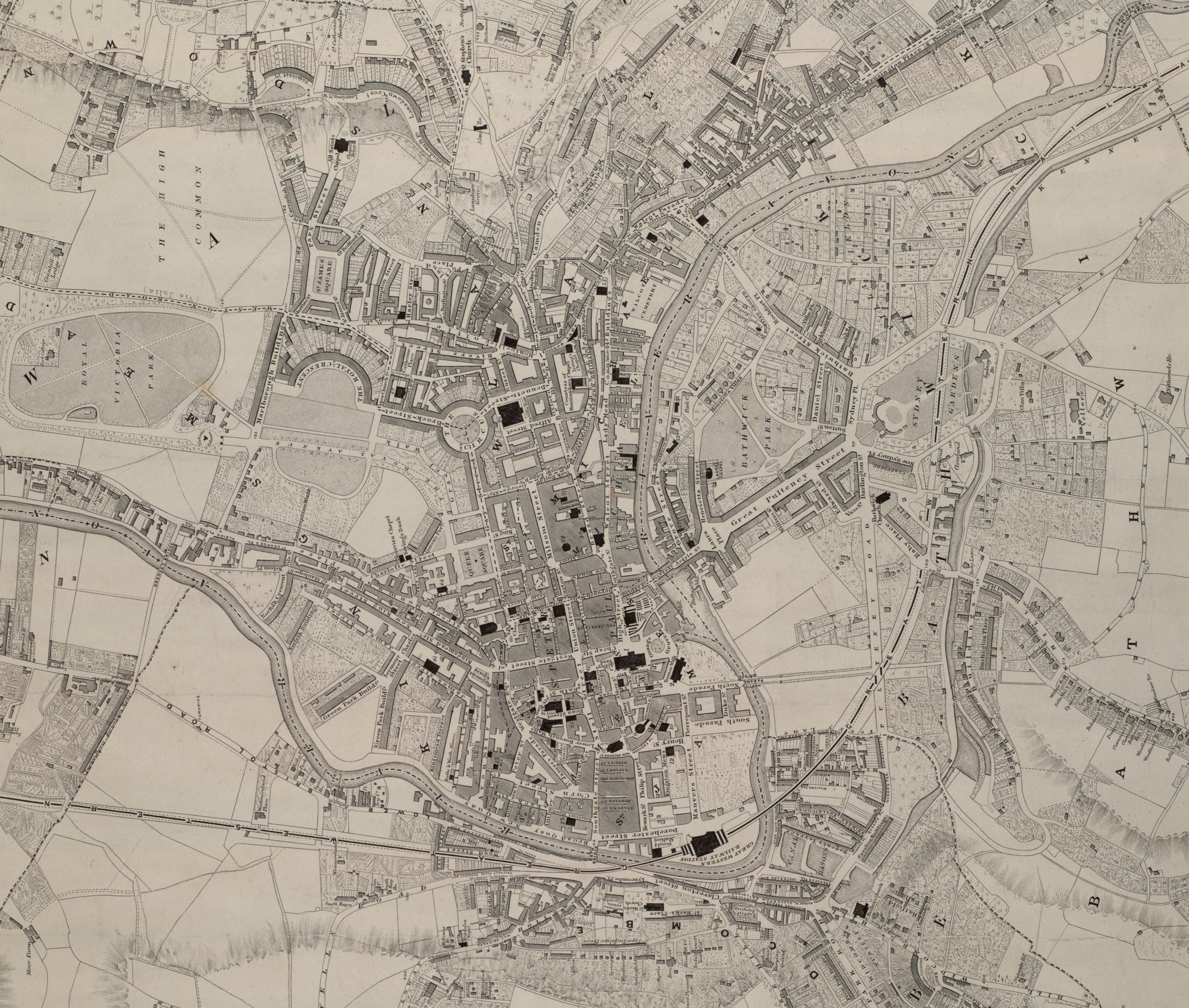
There’s some interesting things about how the map is styled.
Firstly there are various buildings highlighted in black. These include churches, schools, the assembly rooms, museums and postoffice.
Secondly, unlike a modern map which tends to emphasise roads, the roads and streets are not styled. They are delineated by the buildings.
Finally there’s some interesting detailing in the hand-drawn shadings, particularly in the gardens and green spaces. It’s not possible to generate all of that shading, or add the labelling, using prettymaps but I thought it might be possible to approximate at least some of it.
This is what I ended up with.
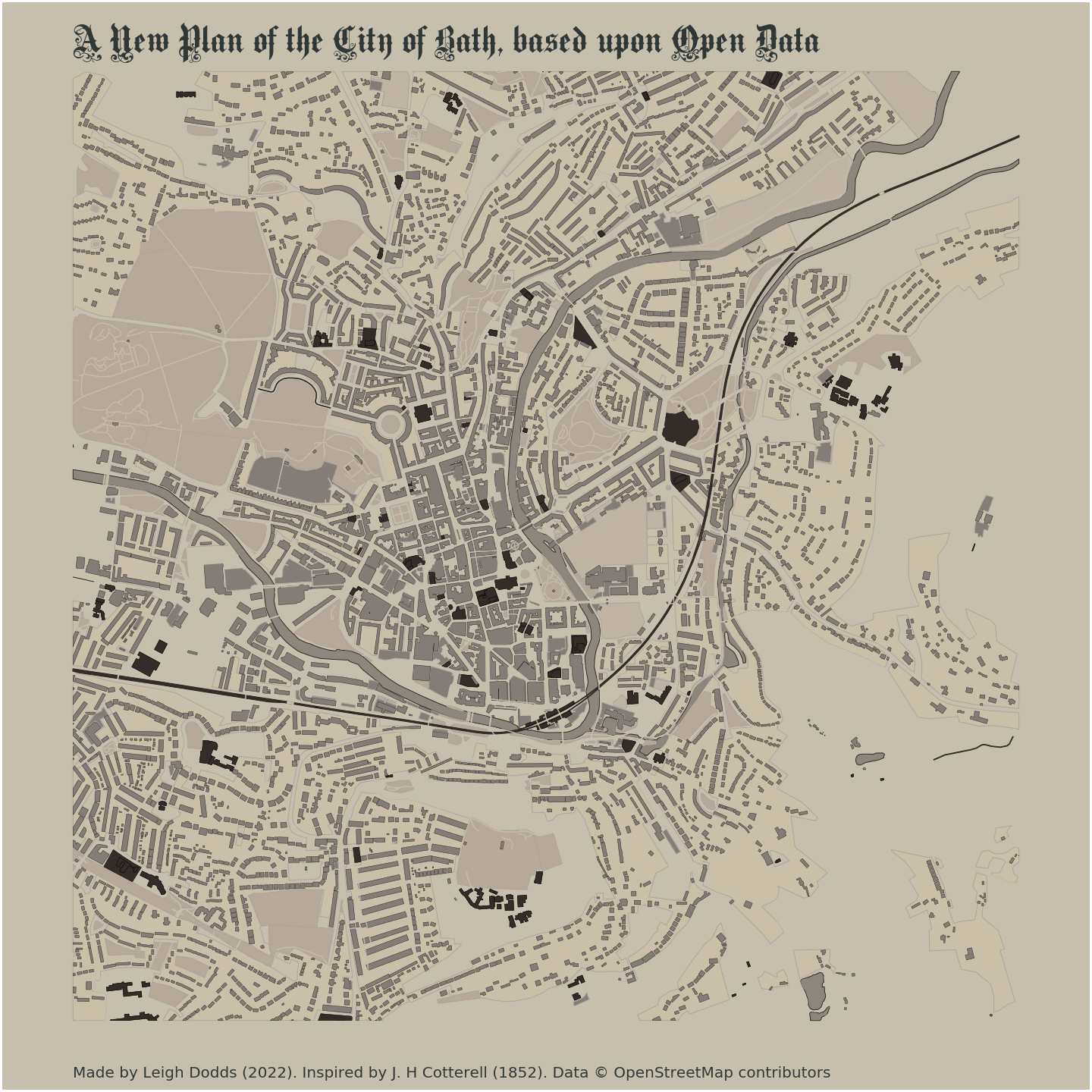
It’s far from perfect, but looks pretty good I think?
The colouring could definitely be better.
Issues with how some features are tagged on OSM make it hard to recreate the original style exactly. For example, the Holbourn Museum doesn’t look great as the whole grounds are tagged as a museum, rather than just the building.
But I do like how the city looks when you don’t focus on the roads (although I did add in the car parks).
If I were to attempt something like this again, I think I’d definitely try using QGIS. But overall I’m pleased with how it’s ended up after a morning of hacking.
Here’s the Google Colab notebook that I used to generate the image.
